

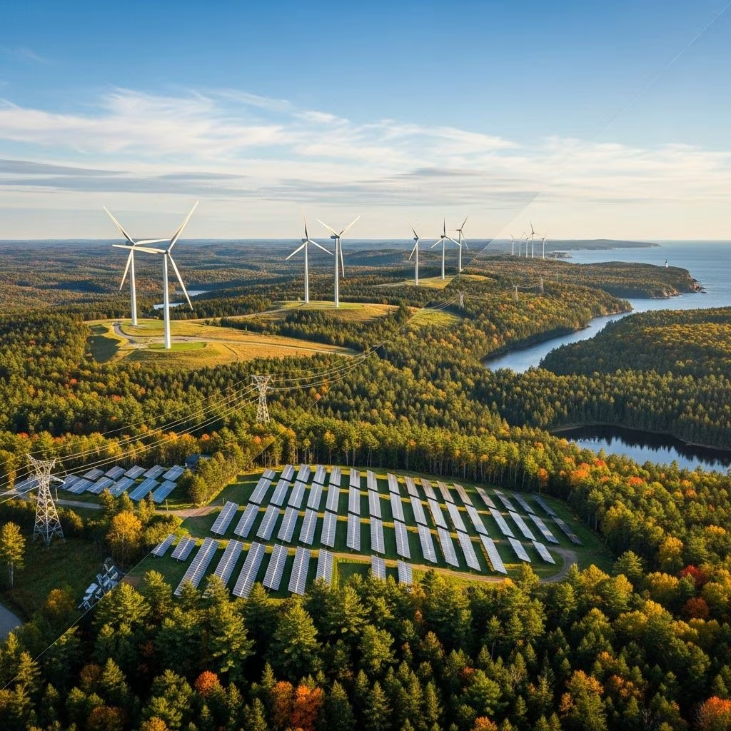
The Challenge: Clean Energy Meets Conservation in Maine
Maine has set some of the nation’s most ambitious clean energy targets: 80% of electricity from renewable resources by 2030 and 100% by 2050. This urgent transition is a direct response to the escalating threats of climate change and the need to secure a sustainable energy future for all residents. Yet, as solar fields, wind farms, and other renewable projects proliferate, new tensions surface—most notably, the potential conflicts between clean energy development and preservation of Maine’s rich natural habitats, wildlife populations, and working lands.
Maine’s diverse landscapes, from dense forests to rocky coasts, are home to countless species, including rare and endangered plants and animals. Poorly planned energy projects risk fragmenting habitats, disrupting migration corridors, and reducing critical ecological resources. Striking a balance—so essential habitats are safeguarded while renewable energy flourishes—requires both innovative tools and collaborative approaches.
The Need for Smarter Siting: Why Conventional Approaches Fall Short
As renewable development ramps up, many communities and developers face daunting questions:
- Where can large-scale solar or wind projects be sited with minimal impact on wildlife and agricultural values?
- How can we avoid sensitive habitats or migration corridors that are otherwise not easily visible on standard maps?
- What guidance and best practices exist for designing and maintaining renewable facilities that truly minimize ecological disturbance?
Until recently, the answers were fragmented across public datasets, local ordinances, scientific reports, and hard-to-access state and federal resources. As a result, well-intended projects too often stumbled into costly conflicts—delaying climate progress and risking irreparable environmental harm.
The Renewable Energy Siting Tool: A Game-Changer for Maine
To address this gap, Maine Audubon, collaborating with state agency partners and technical advisors, launched the Renewable Energy Siting Tool—an advanced, public-facing GIS mapping application. Designed for developers, planners, municipalities, and the general public, the tool integrates dozens of natural resource, land use, and infrastructure data layers to:
- Identify “low-conflict” areas best suited for solar and wind energy projects, by filtering out sensitive habitats, prime agricultural soils, rare species habitat, and essential wildlife corridors.
- Highlight higher-risk zones where careful avoidance, additional study, or mitigation are strongly advised.
- Streamline permitting by allowing users to assess likely regulatory and ecological hurdles early in project planning.
The siting tool empowers stakeholders to make both faster and smarter decisions, supporting Maine’s climate commitments while sustaining the fundamental ecological value that defines the state’s character.
Key Features of the Siting Tool
- Interactive GIS Map aggregates up-to-date layers for wildlife, wetlands, rare species, conservation lands, soils, infrastructure, energy potential, and more.
- Dynamic search and filter functions help users pinpoint parcels or regions that meet both energy and conservation criteria.
- User-friendly interface designed for a wide audience, from policy-makers to landowners and students.
- Integration of data sources not otherwise publicly available, offering a comprehensive view of Maine’s siting landscape.
Guiding Principles: Mitigating Impacts from Day One
The Siting Tool is part of a broader Maine Audubon guidance suite, which includes:
- Model Site Plan Regulations and Conditional Use Permits tailored for municipalities seeking to craft or update their solar and wind ordinances. These models have already informed local law in several towns.
- Best Practices for Low Impact Solar Siting, Design, and Maintenance outlining ways to avoid and minimize harm to natural and agricultural resources.
- Guidance on Pollinator-Friendly Plantings (upcoming), emphasizing the use of native vegetation at solar sites to benefit bees, butterflies, and other pollinators.
Developers and communities are encouraged to address siting impacts at the outset, reducing project risks and regulatory delays later in the process. The toolkit aims to establish a shared language between conservationists and clean energy advocates, fostering solutions that work for both sides.
How the Siting Tool Works: A Walk-Through
Users access the Siting Tool via a publicly available online portal. Upon opening the interactive map, users can:
- Select geographic areas (towns, regions, parcels) to explore site-specific opportunities and constraints.
- Toggle layers on and off, such as rare plant habitats, important bird areas, wetlands, conserved lands, and existing infrastructure.
- Overlay renewable resource maps—like solar irradiance and wind speed—to identify places with strong energy generation potential.
- Use filters to reveal “low-conflict” zones, shaded to indicate a favorable match between energy feasibility and minimal habitat disruption.
- Export data and maps to support decision-making, reporting, and permitting needs.
Real-World Impact: Communities and Conservationists Collaborate
The Siting Tool has already reshaped project conversations across Maine:
- Municipalities are using the model ordinances and best practice guides to revise or craft local laws that protect ecological values while enabling responsible solar and wind growth.
- Developers are screening sites according to natural constraints before making costly investments in acquisition or permitting.
- Conservation groups can proactively identify priority areas to defend—or locations where joint solutions are feasible—helping shift advocacy from opposition to partnership.
As a result, Maine is seeing fewer conflicts at the intersection of renewable energy and wildlife, more rapid progress toward climate goals, and projects that better reflect community values.
Model Site Plan Regulations and Best Practices
- Site Plan Regulations and Conditional Use Permits: Ready-to-adopt model language helps towns set clear expectations for developers, guiding them toward designs that minimize disturbance and preserve local character.
- Best Practices for Low Impact Solar Siting, Design, and Maintenance: Comprehensive guidance addresses topics such as soil conservation, wildlife-friendly fencing, stormwater management, and operations protocols.
- Pollinator-Friendly Planting Guide: (Under development) Will provide detailed advice on integrating native, pollinator-supporting vegetation at solar installations, offering dual benefits for biodiversity and site aesthetics.
Case Study: Offshore Wind and the Gulf of Maine
Maine’s leadership extends to offshore wind in the Gulf of Maine, one of the world’s best places to harness wind power. The Bureau of Ocean Energy Management (BOEM) partnered with conservationists, fishing interests, and local communities to identify wind energy areas that minimize impact on:
- Marine mammals, including the endangered North Atlantic right whale
- Seabird nesting and foraging habitats
- Commercial fisheries
- Sensitive undersea ecosystems
Through rigorous environmental reviews, stakeholder engagement, and iterative mapping, the BOEM’s Final Wind Energy Area was reduced by 85% from initial proposals. This approach exemplifies how science-driven planning and broad collaboration can enable clean energy growth while respecting Maine’s marine biodiversity and existing livelihoods.
Toward a Replicable Model: Lessons for Other States
Maine’s Renewable Energy Siting Tool and associated resources are garnering attention beyond New England as models for responsible development. Key lessons include:
- Integrate data early: Bringing ecological, land use, and energy data together at the start prevents costly mistakes later.
- Engage stakeholders: Successful siting solutions require buy-in from developers, conservationists, municipalities, and residents.
- Balance urgency and caution: The climate crisis demands fast action, but not at the expense of critical habitats and biodiversity.
- Promote transparency: Public-facing tools boost trust and foster collaboration, helping communities make informed, equitable decisions.
States seeking to accelerate renewable adoption without sacrificing natural heritage can look to Maine as an emerging standard.
Looking Ahead: Challenges and Innovations
While Maine’s approach is promising, challenges remain:
- Data gaps still exist, particularly for understudied habitats, rare species, and migratory pathways.
- Maintaining up-to-date maps is labor-intensive and requires ongoing collaboration between data providers, state agencies, and non-profits.
- Regulatory complexity can pose hurdles for small municipalities or new entrants to the renewables market.
- Climate impacts will continue to shift habitats, requiring periodic review and adaptation of siting criteria.
Efforts are underway to expand the Siting Tool’s capabilities, incorporate new research findings, and advance standards for environmental monitoring and adaptive management.
Frequently Asked Questions (FAQs)
Q: Who is the Renewable Energy Siting Tool for?
A: The Siting Tool serves developers, municipalities, conservationists, landowners, educators, and anyone interested in aligning clean energy growth with habitat protection.
Q: Can other states replicate this approach?
A: Yes. Maine’s approach—integrating ecological and land-use data into user-friendly planning tools—offers a model for responsible renewables siting in diverse regions.
Q: Does the Tool guarantee ‘zero impact’ projects?
A: No tool can guarantee zero impact, but the Siting Tool minimizes risks by highlighting best-fit areas and flagging high-conflict zones requiring further study or mitigation.
Q: How often is the Tool updated?
A: Maine Audubon and partners work continually to incorporate the latest data on habitats, infrastructure, and regulations. Users are encouraged to consult the most recent version before making decisions.
Q: What other resources are available to support renewable energy siting?
A: In addition to the Siting Tool, Maine Audubon offers model ordinances, best practices documents, technical guidance, and personalized support for project planning and review.
Conclusion: Toward a Balanced Energy Future
Maine’s Renewable Energy Siting Tool proves that ambitious climate action and wildlife conservation need not be at odds. With integrated planning, transparent data, and collaborative solutions, the state is showing how responsible clean energy development can respect both natural and human communities. As interest in renewables accelerates nationwide, Maine’s example underscores the importance of “smart growth”—where every solar panel and wind turbine is sited with both power generation and habitat health in mind.
References
- https://maineaudubon.org/news/announcing-the-renewable-energy-siting-tool/
- https://www.bangordailynews.com/2021/09/18/bdn-maine/maine-audubon-releases-renewable-energy-guidance-tools/
- https://offshorewind.nwf.org/2025/05/wins-for-wildlife-how-we-worked-to-site-wind-energy-and-protect-wildlife-in-the-gulf-of-maine/
- https://www.maineoffshorewind.org/wp-content/uploads/2023/02/The-Environment-and-Wildlife-Working-Group-Final-Recommendations.pdf
- https://storymaps.arcgis.com/stories/dbde7a8bef5748a8acc0d92891cb2844
- https://www.maine.gov/ifw/docs/2025%20SWAP%20Element%202%20Draft.pdf
- https://steadystate.org/a-two-pronged-energy-approach-to-wildlife-conservation/
- https://www.maine.gov/dep/sustainability/climate/adaptation-toolkit.html
- https://digitalcommons.library.umaine.edu/cgi/viewcontent.cgi?article=1938&context=mpr