

Mapping the World’s Forests: A Global Perspective
Forests serve as the green lungs of our planet, regulating climate, sustaining biodiversity, supporting indigenous communities, and providing vital resources for both nature and humans. Understanding where the world’s forests are, how they are changing, and what these changes mean is key to shaping global environmental policies and conservation efforts. With recent advances in satellite technology and global data analysis, our knowledge of Earth’s forests is deeper—and more urgent—than ever before.
Forests: The Earth’s Canopy
Spanning 31% of the world’s land surface, forests are not just a veil of green seen from above—they comprise rich ecosystems that shape life on Earth. According to recent estimates, there are roughly 3.04 trillion trees on the planet, far surpassing earlier guesses and highlighting the immense scale and diversity of global forests.
- Forests cover about 4.06 billion hectares worldwide.
- Tropical regions are home to the largest concentrations of trees, followed by boreal and temperate forests.
- Despite their vastness, forests are under severe threat from deforestation, degradation, and climate change.
The Power of Mapping: How We Understand Forests
Mapping forests has evolved from paper sketches to high-resolution satellite imagery analyzed by artificial intelligence. Tools like Global Forest Watch now allow us to monitor tree cover, detect losses and gains in near real-time, and visualize trends that influence conservation and policy decisions.
- Satellite imagery enables tracking of even single trees at meter-scale accuracy.
- Artificial intelligence, such as models developed by Meta and partners, provides three-dimensional canopy height maps using billions of pixels and comprehensive data sources.
- Interactive platforms democratize access to data, empowering citizens, researchers, and governments alike.
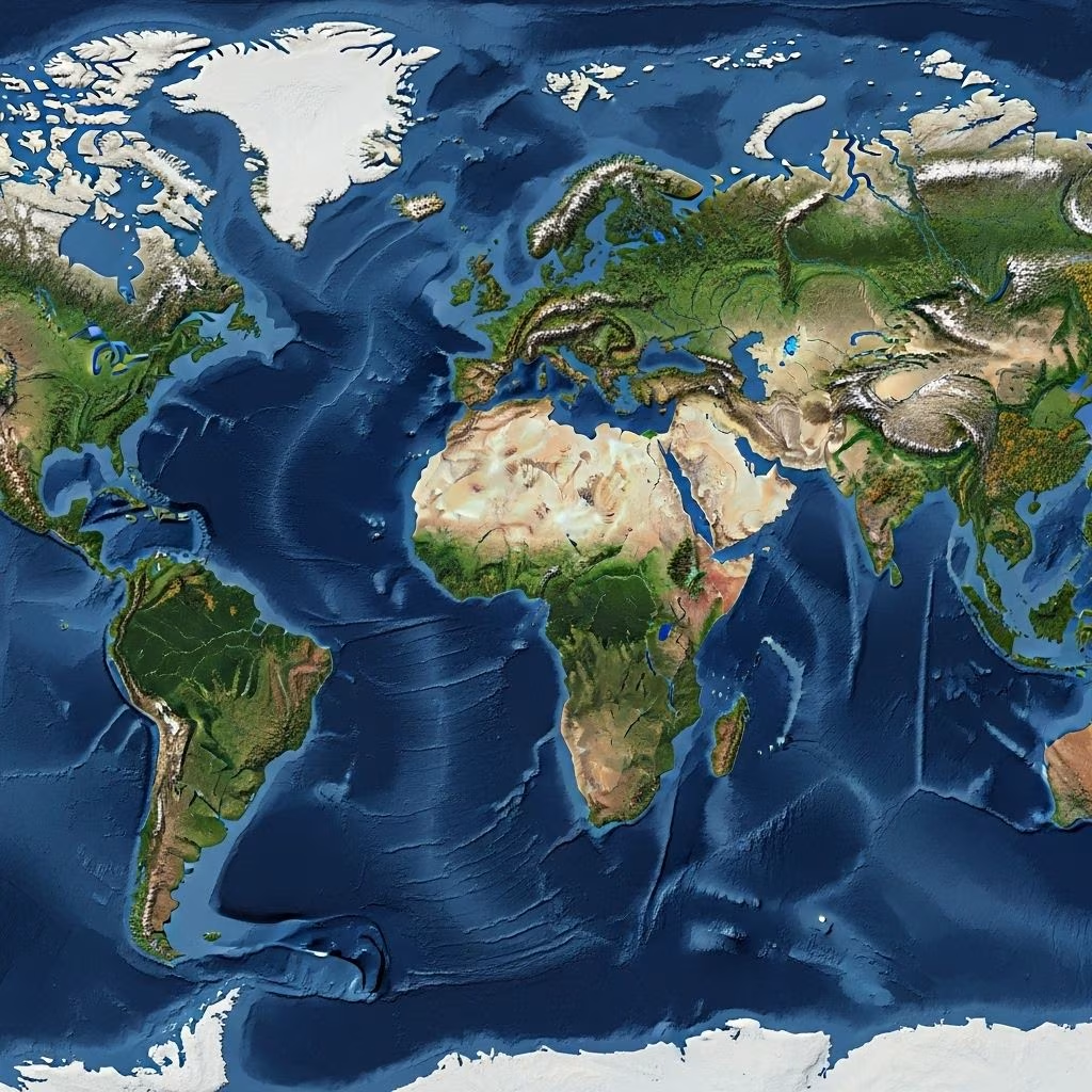
Global Forest Distribution: An Overview
Forests are distributed unevenly across the globe, mirroring climate patterns, geography, and human history. The following regions host Earth’s major forest biomes:
| Region | Biome Type | Estimated Area (million ha) | Key Characteristics |
|---|---|---|---|
| South America | Tropical Rainforest | ~840 | Amazon, largest biodiversity, major carbon sink |
| Russia | Boreal | ~815 | World’s largest continuous forest, vast carbon stores |
| North America | Temperate & Boreal | ~750 | Diverse forests from taiga to redwoods |
| Africa | Tropical & Subtropical | ~624 | Congo Basin, critical for regional climate |
| Asia | Tropical, Subtropical, Temperate | ~593 | Home to diverse forest types from Siberia to Indonesia |
| Europe | Temperate & Boreal | ~215 | Managed forests, historical deforestation and recovery |
| Oceania | Tropical & Temperate | ~191 | Islands, Australia’s eucalyptus and rainforests |
The Anatomy of Forest Change: Losses and Gains
One of the most striking findings from global mapping initiatives is the imbalance between forest loss and gain. Data from the Global Forest Watch and the University of Maryland reveals:
- Between 2000 and 2012, the world lost 2.3 million square kilometers of tree cover—equivalent to 50 soccer fields per minute.
- During the same period, about 0.8 million square kilometers of forests regrew, were planted, or restored.
- Annual tree loss often outpaces gains, particularly in tropical regions with high rates of deforestation.
- Since the start of human civilization, the global number of trees has declined by approximately 46%.
This trend highlights urgent challenges for conservation and the need for sustainable management of forest resources.
Forests Under Threat: Drivers of Deforestation
The primary drivers of global forest loss are varied, often driven by human activities and market forces. Major threats include:
- Commercial agriculture: Expansion for crops like oil palm, soy, and cattle pasture removes vast swaths of tropical forests.
- Logging: Both legal and illegal timber harvests impact primary forests, especially in Southeast Asia, Russia, and South America.
- Fire: Deliberate burning and uncontrolled wildfires devastate millions of hectares annually, as witnessed in the Amazon and Australia.
- Infrastructure development: Roads, mining, and urban expansion contribute to habitat fragmentation.
- Climate change: Amplifies risks of drought, disease, and destructive insect outbreaks, altering forest composition and health.
Why Forests Matter: The Value of Trees
The services provided by forests are invaluable and interconnected with global well-being:
- Carbon Storage: Forests act as carbon sinks, absorbing around one-third of annual human-caused carbon dioxide emissions, playing a crucial role in mitigating climate change.
- Biodiversity: Forest ecosystems shelter 80% of terrestrial plant and animal species, forming the backbone of biological diversity.
- Hydrology: Forests regulate water cycles, protect watersheds, and reduce soil erosion, safeguarding freshwater supplies.
- Livelihoods: Over 1.6 billion people depend directly on forests for food, shelter, medicine, and income.
- Resilience: Healthy forests are better able to recover from storms, pests, and stresses, providing buffers for communities against disasters.
Mapping Tools: Who Benefits and How?
Accessible forest data empowers diverse stakeholders to take informed action, safeguard forests, and foster accountability:
- Governments monitor, enforce, and shape forest policies based on up-to-date spatial data.
- Non-Governmental Organizations (NGOs) identify deforestation hotspots and mobilize conservation efforts.
- Indigenous communities track encroachment and document events in customary lands using live map updates and uploads.
- Businesses evaluate supply chain sustainability, ensuring commodities are sourced from responsibly managed forests.
- Citizens and educators gain a window into the health of the world’s forests, encouraging public awareness and stewardship.
The Role of Advanced Technology: AI and High-Resolution Mapping
Modern mapping leverages big data, AI, and high-definition imagery to enhance forest monitoring:
- AI-driven models predict canopy height with meter-level accuracy, enabling not just area measurements but also vertical forest structure assessment.
- Analysis of trillions of pixels from drone, satellite, and aerial data accelerates detection of changes in forests, aiding timely interventions.
- Open-access platforms, such as those powered by Global Forest Watch, enable stakeholders worldwide to monitor, report on, and respond to forest changes with unprecedented speed.
Regional Highlights: Forests Around the World
1. The Amazon Basin
The world’s largest tropical rainforest, containing more biodiversity than any other land region, is still being lost at an alarming rate, primarily due to agriculture and infrastructure development.
2. Boreal Forests of Siberia and Canada
These vast forests act as critical carbon reservoirs but are increasingly threatened by wildfires and changing climate patterns.
3. Southeast Asian Tropical Forests
From Borneo to the Mekong, these regions are losing forests rapidly to palm oil, logging, and urban expansion, jeopardizing unique wildlife and ecosystem services.
4. Central African Forests
The Congo Basin is the world’s second-largest rainforest, vital for regional hydrology and home to rare species like gorillas and forest elephants.
5. European and Mediterranean Forests
Europe’s forests are seeing some recovery after centuries of decline, yet are still fragmented and face threats from urbanization and intensive management.
Interactive Mapping: How to Explore Forest Data
Want to see the world’s forests in action?
- Explore live loss and gain layers, zoom into specific regions, and analyze trends with interactive mapping tools.
- Upload local observations or satellite imagery to validate data or alert global audiences to illegal logging and encroachment.
- Download region-specific data for research, reporting, or advocacy.
The Path Forward: Protecting Earth’s Forests
Forest loss is not inevitable. In many regions, policies focused on reforestation, protected areas, sustainable land use, and respectful integration of local communities have succeeded in reversing negative trends. The road to a sustainable future for forests includes:
- Strengthening policy frameworks and legal enforcement.
- Investing in restoration and plantation initiatives where appropriate.
- Promoting sustainable agriculture and commodity certification standards.
- Empowering indigenous and local stakeholders as custodians of their lands.
- Leveraging global forest data to inform climate and biodiversity strategies.
Frequently Asked Questions (FAQs)
Q: Which country has the largest forest area?
A: Russia holds the largest forest area globally, with more than 800 million hectares, followed by Brazil, Canada, and the United States.
Q: What is the primary cause of forest loss?
A: The leading drivers are conversion for agriculture (such as cattle and crops), unsustainable logging, fire, and infrastructure development.
Q: Are forests recovering anywhere?
A: Some areas, especially in parts of Europe, North America, and Asia, are seeing net gains due to reforestation programs and natural regrowth. However, gains are generally outpaced by losses in tropical regions.
Q: How accurate are satellite-based forest maps?
A: Current technology, using AI and high-resolution imagery, achieves canopy height prediction with a mean absolute error under 3 meters, enabling precise local and global assessments.
Q: How can I contribute to mapping and protecting forests?
A: Anyone can use platforms like Global Forest Watch to monitor, report, and raise awareness about local and global forest issues. Data sharing, volunteering, and supporting conservation organizations also help protect forests worldwide.
References
- https://www.wri.org/insights/9-maps-explain-worlds-forests
- https://sustainability.atmeta.com/blog/2024/04/22/using-artificial-intelligence-to-map-the-earths-forests/
- https://www.nature.com/articles/nature14967
- https://www.globalforestwatch.org/map/
- https://www.weforum.org/stories/2023/01/mapping-worlds-forests-green-globe-climate-change/
- https://www.treehuggerpod.com/episodes/climate-ready-forests