

NASA’s Curiosity Rover: A Visual Journey Across Mars
Since landing on Mars in August 2012, NASA’s Curiosity rover has captured an array of breathtaking images. From dusty plains and towering dunes to the slopes of Mount Sharp and the depths of Gale Crater, Curiosity’s camera has become humanity’s window to the Red Planet. This article presents a curated gallery of the rover’s most stunning and scientifically significant images, revealing both the beauty and mystery of Mars.
Curiosity Mission Overview
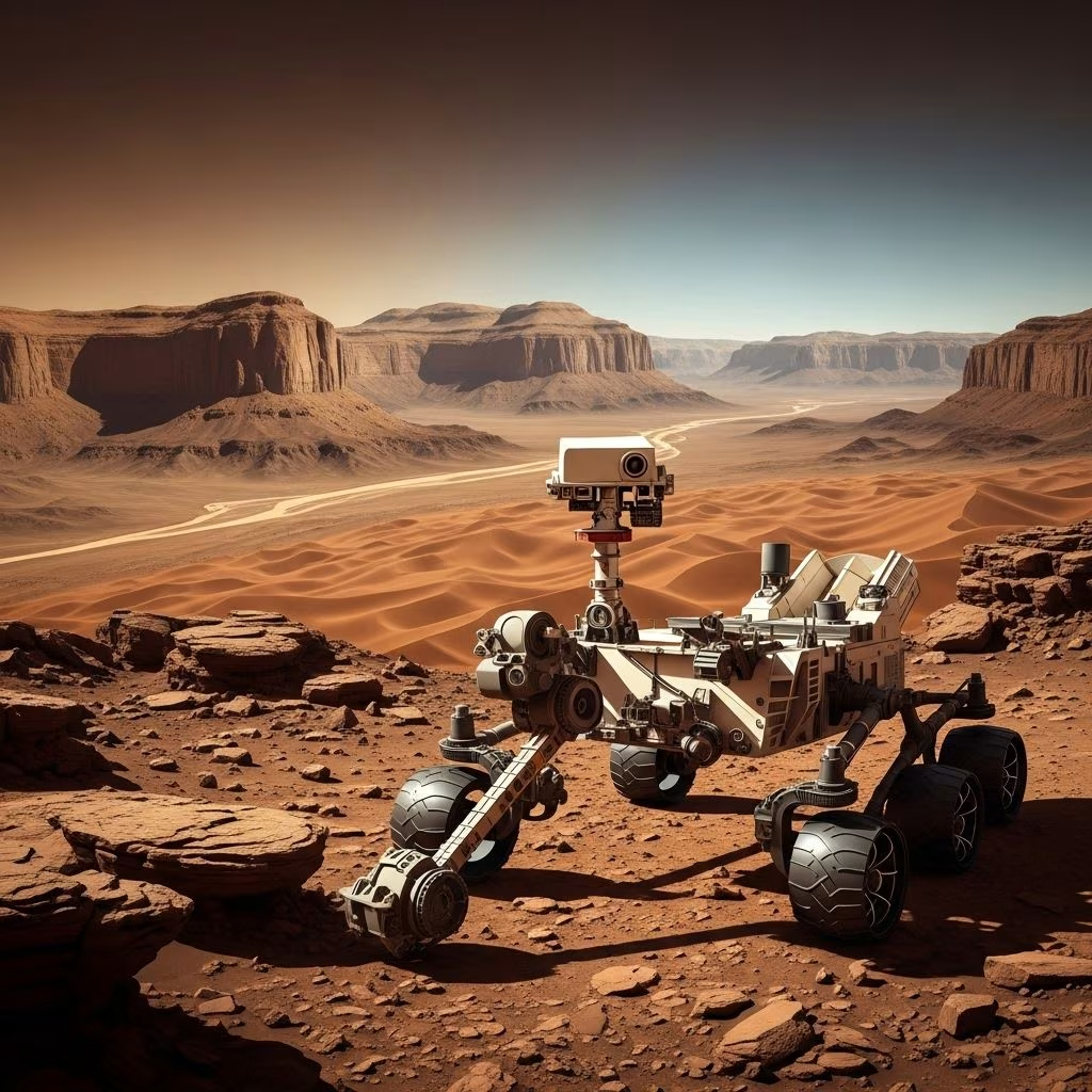
Curiosity is a car-sized rover part of NASA’s Mars Science Laboratory (MSL) mission. Landing in Gale Crater in 2012, it was designed to explore Mars’ habitability and geology, seeking clues about ancient water activity and the planet’s potential for supporting life. Originally intended for a two-year mission, Curiosity has continued for over a decade, traversing nearly 30 kilometers across varied Martian terrains.
- Launched: November 26, 2011
- Landed: August 6, 2012, inside Gale Crater
- Key objectives: Assess Mars’ climate and geology, search for signs of ancient life, gather data for future human missions
- Most recent activities: Climbing Mount Sharp, investigating sulfate-rich units, capturing high-resolution panoramas[11].
Mars Landscape & Terrain Features
Mars boasts a diversity of landscapes rivaling any on Earth. Curiosity’s camera suite, including Mastcam, ChemCam, and MAHLI, has recorded:
- Rocky Plains: Vast desert-like expanses covered in dust, scattered rocks, and wind-shaped features.
- Layered Outcrops: Sedimentary rock layers preserving the geological history of ancient lakes, rivers, and possibly habitable environments.
- Crater Rims and Buttes: Towering ridges, mesas, and buttes formed by erosion, impact events, and volcanic activity.
- Mountain Slopes: The gradual ascent of Mount Sharp, a central mound rising about 5.5 km (18,000 feet) above the Gale Crater floor.
Each image from Curiosity contributes to a broader understanding of how Mars’ surface has evolved over billions of years.
High-Resolution Panoramas
One of Curiosity’s signature achievements is the creation of some of the most detailed panoramas ever assembled on another world. These images, stitched from hundreds or thousands of individual photographs, present viewers with a sweeping virtual tour of Martian vistas.
Key Panoramic Highlights
- Glen Torridon Panorama: Over 1.8 billion pixels, this mosaic reveals the rugged landscape of the Glen Torridon region on Mount Sharp. It’s the most detailed panorama from Mars to date, showcasing wind-carved hills and distant ridge lines[11].
- Rocknest Region: A 1.3-billion-pixel panorama revealing the spot where Curiosity made its first Martian soil analysis in 2013, capturing dunes, the base of Mount Sharp, and crater walls.
- Murray Buttes: Detailed 360-degree panoramas of Martian mesas and buttes, reminiscent of the American Southwest, highlighting erosion and ancient sedimentary layers.
These images let scientists—and the public—explore Martian terrain in unprecedented detail, revealing both major landforms and subtle textures.
Ripples and Dune Fields
Curiosity has crossed extensive fields of Martian sand dunes, documenting both their beautiful formations and their scientific significance:
- Bagnold Dune Field: A sweeping expanse of dark, basaltic sand dunes on the northwest flank of Mount Sharp. Images reveal sharp crests and complex wind-driven patterns.
- Surface Ripples: The rover’s close-up photographs highlight wind-sculpted ripples and fine grains, helping researchers understand Martian wind dynamics and sediment transport over time.
- Crossing Dune Boundaries: Curiosity’s wheels left distinctive tracks as it traversed steep slopes and soft dune surfaces, sometimes slipping or forming trench-like marks in the loose sand.
The study of Martian dunes not only provides insight into current atmospheric processes but also preserves clues to past climate variations on the planet.
Meteorites on Mars
Among its many discoveries, Curiosity has encountered and investigated several meteorites resting on the Martian surface:
- Egg Rock Meteorite: A fist-sized, iron-nickel meteorite, found near the Murray Buttes, which Curiosity examined up close using its robotic arm and laser tools.
- Other Metallic Fragments: Images reveal shiny, pitted surfaces, distinguishing these objects from native Martian rocks.
Studying meteorites on Mars gives scientists clues about both interplanetary material and Mars’ own thin atmosphere, which allows many such objects to reach the surface intact.
Martian Sunsets & Skies
Mars’ sky, tinged with ochre and pink by day, transforms into blue-tinged hues during twilight. Curiosity has captured some of the most evocative Martian sunsets ever seen:
- Sunset in Gale Crater: A series of images shows the Sun setting behind the distant rim of Gale Crater, turning the normally salmon sky to a cool blue as dust scatters the sunlight differently than on Earth.
- Dust Storms: During regional dust storms, Curiosity’s cameras record the sky becoming dim and shadowless, illustrating weather phenomena unique to Mars.
These sunset images do more than just delight—they help scientists study atmospheric dust content and weather changes on Mars.
Curiosity: The Self-Portrait Gallery
Curiosity has become famous for its creative and sometimes playful selfies. Using the Mars Hand Lens Imager (MAHLI) mounted on its robotic arm, the rover takes a series of images from various angles and digitally stitches them together for a full view.
Notable Selfie Locations
- Rocknest and “Duluth”: Showcasing the dust-covered rover against wind-sculpted dunes and outcrops.
- Mount Sharp’s Slopes: Documenting the rover’s steady ascent, with the imposing mound looming in the background.
- Drilling Sites: Each self-portrait often highlights a scientific achievement—such as freshly drilled holes or scooped regolith samples from the surrounding rock.
These images symbolize Curiosity’s enduring presence and technical prowess, serving as both documentation and a record of progress over its years-long mission.
Mount Sharp: Scientific Highlights
Mount Sharp (Aeolis Mons) is a 5-kilometer-high mountain rising from Gale Crater’s center. Curiosity’s journey up its flank represents a trek through Martian history, as each new sediment layer reveals records from different climatic eras.
- First Sampling Holes: Drilling into varied rock layers, Curiosity found clays and sulfates indicating past water activity and changing environments over time.
- Murray Buttes: The rover’s passage through this scenic region offered close-up looks at buttes and mesas formed through billions of years of erosion, shedding light on how wind and water shaped Mars.
- Sulfate Unit: Recent images taken as Curiosity traverses this zone show mineral veins, lighter-colored rocks, and steep, dust-mantled slopes thought to mark an ancient shift from wetter to drier conditions.
Each step up Mount Sharp is a step backward in time, revealing the environmental story of ancient Mars.
Oddities and Unusual Finds
Besides sweeping landscapes, Curiosity’s sharp eyes have uncovered strange features and intriguing patterns:
- Spiderweb Patterns: Network-like formations in Martian soil, interpreted as surface cracks or possibly related to subsurface gas activity.
- Intersecting Ridges: Recent images reveal three prominent ridges crossing Gale Crater’s terrain, creating visually striking formations—an invitation for further scientific study.
- Shadow Play: Dazzling photos of unusual light and shadow patterns formed by the low Martian Sun and scattered boulders.
Every puzzling feature serves as a reminder of how much remains to be discovered on Mars’ dynamic and alien surface.
Frequently Asked Questions (FAQs)
Q: How does Curiosity take its images?
A: Curiosity is equipped with multiple cameras, including Mastcam for color images, MAHLI for close-ups and selfies, and Navcams for navigation. High-resolution mosaics are created by stitching together dozens or hundreds of individual images.
Q: Why do Martian sunsets look blue?
A: On Mars, dust in the atmosphere scatters sunlight differently than on Earth, making the sky pinkish during the day and bluish when the Sun is low on the horizon.
Q: What is Curiosity’s biggest scientific achievement?
A: Curiosity discovered ancient clay minerals and chemical signatures, providing strong evidence that Gale Crater once hosted lakes and a potentially habitable environment.
Q: Has Curiosity found signs of life on Mars?
A: Curiosity has not found signs of present or past life. However, its discoveries about ancient habitability lay groundwork for future missions targeting biosignatures.
Q: How long will Curiosity keep exploring?
A: Curiosity’s mission has been extended several times. As long as its nuclear power supply and critical systems remain healthy, it will continue exploring and sending back stunning images.
Mars Image Gallery (Descriptions)
| Image Title | Description | Significance |
|---|---|---|
| Ripples on Martian Dune | Fine sand ripples captured on the Bagnold Dune field, revealing active wind processes on Mars. | Helps scientists track modern weather and particle movement. |
| Meteorite on Mars | An iron-nickel meteorite, showcasing shiny, pitted surfaces among local rocks. | Offers insights into Mars’ atmosphere and exposure to cosmic material. |
| Sunset in Gale Crater | The Sun sets behind the crater’s rim, tinting the sky blue while the Martian plains fade into shadow. | Reveals unique atmospheric scattering due to fine dust. |
| Selfie at Duluth | The rover stands beside a freshly drilled sample site, dusty and battered yet operational. | Documents rover health and mission milestones. |
| Panorama of Murray Buttes | A grand mosaic showing mesas, buttes, and layered rocks reminiscent of the American West. | Illustrates ancient geology and erosion. |
Conclusion: Mars Through Curiosity’s Lens
The Curiosity rover has been our robotic scout, photographer, and scientist on Mars for more than a decade. Every image it sends enhances not only our scientific knowledge but also our sense of connection to another world. From sprawling landscapes to evocative sunsets, rocky outcrops, and mysterious oddities, Curiosity’s images continue to captivate and inspire, reminding us of the beauty and intrigue waiting beyond Earth.
References
- https://svs.gsfc.nasa.gov/31343/
- https://photojournal.jpl.nasa.gov/spacecraft/Curiosity
- https://www.space.com/astronomy/nasas-curiosity-rover-takes-a-closer-look-at-spiderwebs-on-mars-space-photo-of-the-day-for-july-1-2025
- https://www.youtube.com/watch?v=kuwNK3WOenA
- https://www.youtube.com/watch?v=H5z32E7uaKM
- https://www.cnet.com/pictures/nasa-curiosity-rover-mars-images-anniversary-landing-5/
- https://www.demilked.com/nasa-curiosity-rover-photos/
- https://www.space.com/astronomy/mars/curiosity-rover-images-3-intersecting-mars-ridges-space-photo-of-the-day-for-aug-21-2025
- https://www.friendsofnasa.org/2025/03/planet-mars-images-march-6-9-2025-nasas.html
- https://www.boredpanda.com/mars-curiosity-7-years-photos-nasa/
- https://newatlas.com/space/nasa-curiosity-best-mars-panorama/
- https://www.friendsofnasa.org/2025/03/planet-mars-images-march-14-16-2025.html
- https://en.wikipedia.org/wiki/Curiosity_(rover)
- https://www.skyatnightmagazine.com/news/curiosity-rover-photograph-mars-reconnaissance-orbiter
- https://time.com/51476/interactive-360-panorama-from-mars-curiosity-rover/
- https://orbitaltoday.com/2025/04/28/nasa-orbiter-photographs-the-curiosity-rover-as-it-navigates-mars/