

Zooming in on Mars: A New Era of Planetary Exploration
If you relish losing yourself in satellite images on platforms like Google Earth, prepare to embark on a new adventure—this time on a different planet. NASA, in collaboration with the Bruce Murray Laboratory for Planetary Visualization at the California Institute of Technology, has unveiled the most detailed 3D map of Mars ever created, offering an extraordinary window into the Red Planet’s striking terrain.
The Genesis of the Global CTX Mosaic
The star of this breakthrough is the interactive Global CTX Mosaic of Mars, a massive image mosaic crafted from pictures snapped by NASA’s Mars Reconnaissance Orbiter (MRO). Specifically, the mosaic was pieced together using data from the Orbiter’s black-and-white Context Camera (CTX). This camera, operating on the MRO since its launch, has tirelessly surveyed Mars, capturing the planet’s surface in unprecedented detail.
- Project Duration: 6 years of image processing and assembly
- Total Images Used: Approximately 110,000 individual CTX images
- Manual Assembly: 13,000 images were positioned by hand for completeness and accuracy
- Resolution: Each pixel covers about 25 square meters (270 square feet) of Martian terrain
- Overall Coverage: 99.5% of the Martian surface, spanning latitudes from 88°S to 88°N
- Total Pixels: 5.7 trillion (5.7 terapixels), making the map larger than a football field if printed at full scale
Behind the Scenes: The Mosaic Creation Process
Bringing together such an extensive dataset was no small feat. While much of the data organization relied on sophisticated computer algorithms, the final touch was deeply human—over 13,000 images required manual alignment by researchers, ensuring seamless joins and full planetary coverage.
The project showcased both computational ingenuity and painstaking scientific dedication. Automation enabled the team to efficiently handle the enormous influx of imagery, but human oversight guaranteed the highest possible quality and traceability for scientific research.
Step-by-Step Creation Process
- Automated algorithms matched and stitched most images into a coherent planetary map.
- Manual intervention addressed ambiguous or challenging terrain, as well as areas needing visual correction.
- Meticulous validation guaranteed that every region could be mapped back to its original source image, providing full data traceability.
Exploring the Martian Surface in Depth
With the Global CTX Mosaic, both professionals and the public can traverse Mars in ways never before possible. The map is so detailed that certain features are rendered with a clarity equivalent to the size of a parking space. The interactive map allows users to:
- Zoom in on regions of scientific interest, such as mineral deposits, crater rims, or ancient riverbeds.
- Track the routes of famous rovers such as Curiosity (Gale Crater) and Perseverance (Jezero Crater).
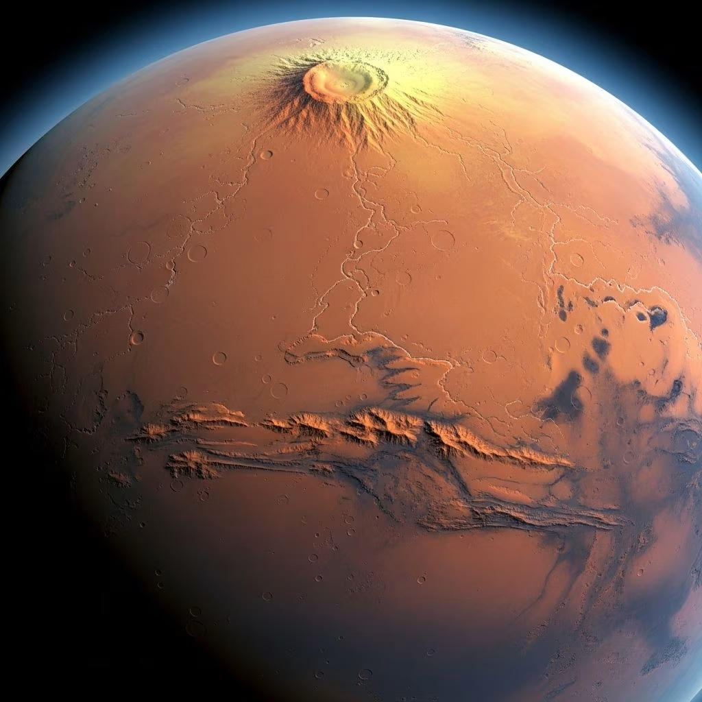
- Tour iconic Martian landmarks, including Olympus Mons—the solar system’s tallest volcano—and vast canyons or dust devil tracks.
- Switch between wide planetary views and detailed local terrain analysis, making the map useful for both armchair explorers and scientific mission planning.
Why the Map Matters for Science
Beyond its appeal to the public, the detailed map underpins genuine scientific research:
- Provides context for localized rover observations by enabling researchers to see the broader terrain in which data was collected.
- Helps in identifying potential landing sites for future missions, based on accessible, high-resolution imagery.
- Tracks seasonal or environmental changes by comparing the CTX mosaic with new and historic orbital data.
Technology Behind the Map: Mars Reconnaissance Orbiter & CTX
The driving force behind this achievement is the Mars Reconnaissance Orbiter (MRO), launched in 2005 by NASA. The MRO has revolutionized our understanding of Mars through a suite of advanced instruments, chief among them the Context Camera (CTX):
| Instrument | Function | Resolution |
|---|---|---|
| Context Camera (CTX) | Wide surface imagery for global mapping | 5–6 meters per pixel |
| HiRISE | High-resolution imaging for detailed terrain study | 0.25–0.5 meters per pixel |
| MCS | Mars Climate Sounder for weather and climate studies | N/A (Spectrometer) |
The CTX camera, operated by Malin Space Science Systems, was built for the specific goal of mapping the planetary surface at high fidelity, providing an ideal dataset for such a comprehensive mosaic.
The Impact on Mars Research and Future Missions
The release of the 3D mosaic marks a watershed moment for planetary science. According to NASA and project collaborators, the map is both visually stunning and scientifically invaluable. As Laura Gerber, a Mars scientist at NASA’s Jet Propulsion Laboratory, remarked, “It’s both a beautiful product of art and also useful for science.”
Key Benefits for Science and Public Engagement
- Accelerates mission planning by supplying context for landing site selection and hazard identification.
- Provides a resource for tracking geomorphological changes and seasonal phenomena on Mars.
- Broadens public accessibility, letting anyone explore Mars with near-professional-grade data.
How to Access and Use the Interactive Mosaic
The Global CTX Mosaic is freely available for streaming and exploration online. Thanks to careful engineering, you can:
- Navigate the mosaic directly in your web browser—no special 3D glasses or hardware required.
- Fly over vast Martian fields, canyons, and volcanoes, adjusting your altitude and perspective on the fly.
- Instantly access labels for regions of interest and rover landing sites, facilitating at-a-glance education and navigation.
- Download segments or the entire dataset for offline analysis or educational projects.
Virtual Exploration: Tour the Red Planet from Home
With this interactive map, everyone can become a virtual Mars explorer. Key regions and features to check out include:
- Gale Crater – Home to NASA’s Curiosity rover and the site of important geological discoveries
- Jezero Crater – Landing site of the Perseverance rover, crucial for understanding past water activity
- Olympus Mons – The tallest known volcano in our solar system
- Valles Marineris – A sprawling canyon system rivaling Earth’s largest
- Dust devil tracks, impact craters, and river-like valleys etched across the landscape
Armchair astronomers can easily switch between locations, adjust their perspective, and appreciate the scale and beauty of our planetary neighbor.
Frequently Asked Questions (FAQs)
Q: How detailed is the new Mars 3D map?
A: The map covers 99.5% of the Martian surface, with each pixel representing about 25 square meters, totaling 5.7 terapixels for the entire mosaic.
Q: What technology was used to create the map?
A: The mosaic is primarily compiled from the Context Camera (CTX) onboard NASA’s Mars Reconnaissance Orbiter, using both algorithmic and manual stitching techniques.
Q: Who can access the Mars 3D map?
A: The map is publicly accessible online; anyone can explore it via a web browser, making it an invaluable resource for scientists, educators, and enthusiasts alike.
Q: What scientific benefits does the map provide?
A: The mosaic enables detailed study of large- and small-scale geological features, assists in mission planning, and supports research by providing context for rover data and surface changes over time.
Q: Can users view the current positions and paths of Mars rovers?
A: Yes, the map shows the routes of major Mars missions, including Curiosity and Perseverance, helping users trace exploration history and ongoing research locations.
Key Takeaways and the Future of Mars Mapping
- The release of NASA’s high-resolution 3D map signifies a leap forward in the democratization of space data and planetary exploration.
- Researchers now have a comprehensive, easily referenced foundation for the next generation of Mars science and exploration missions.
- Students, teachers, and the public at large can engage with real Martian data, fostering interest and discovery in planetary science.
As Mars continues to fascinate and mystify, resources like the Global CTX Mosaic ensure that our understanding keeps pace with our curiosity—laying the foundation for new discoveries, future explorations, and continued inspiration across the globe.
References
- https://www.space.com/high-resolution-3d-mars-map-mro
- http://mars3dmap.com
- https://www.the-nref.org/content/tour-hi-res-3d-map-surface-mars
- https://www.cgtrader.com/3d-models/space/spaceship/mars-reconnaissance-orbiter
- https://www.youtube.com/watch?v=EpfgUnzJE3I
- https://www.jpl.nasa.gov/images/pia21487-a-decade-of-compiling-the-sharpest-mars-map/
- https://www.jpl.nasa.gov/missions/mars-reconnaissance-orbiter-mro/
- https://www.space.com/mars-map-archive-usgs-mro-video
- https://news.sky.com/story/nasas-new-mars-map-lets-you-explore-the-planet-for-yourself-in-3d-12855003
- https://www.youtube.com/watch?v=ngQ_kqCJTfI
- https://www.maps.com/3d-mars-map-shows-red-planet-in-high-resolution
- https://solarviews.com/eng/mars3d.htm
- https://www.theregister.com/2023/04/08/mars_caltech_map/
- https://space-axiom.com/nasa-unveils-the-most-detailed-3d-map-of-mars/
- https://meetingorganizer.copernicus.org/EPSC-DPS2019/EPSC-DPS2019-1600-2.pdf
- https://news.arizona.edu/news/hirise-camera-captures-high-resolution-3-d-images-mars
- https://www.tweaktown.com/news/91003/nasa-releases-the-most-detailed-3d-map-of-mars-ever-google-earth-but-for/index.html
- https://sketchfab.com/3d-models/nasa-mromars-reconnaissance-orbiter-717c46f6a22346aebaad76a6e91892e0