

Satellite Sleuths and the Enigma of Noah’s Ark
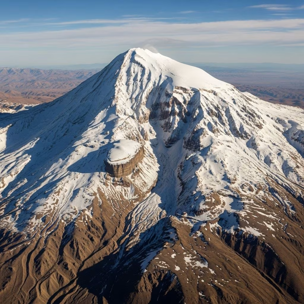
The tale of Noah’s Ark—a vessel built to preserve life through an ancient deluge—has captivated the human imagination for generations. For decades, Mount Ararat, an icy sentinel rising from eastern Turkey, has stood at the heart of modern searches for the Ark’s possible remains. Speculation, fueled by tantalizing clues, persistent legends, and, more recently, the powerful eye of satellite technology, has kept this biblical mystery alive well into the modern scientific age.
At the core of this quest is the so-called Ararat anomaly, a peculiar formation high on the mountain’s northwest slope, repeatedly spotted in aerial and satellite images and subject to intense scrutiny by researchers and enthusiasts alike.
The Allure of the Ararat Anomaly
The Ararat anomaly is a seemingly unusual feature detected at an elevation of about 15,500 feet (4,724 meters) on Mount Ararat. First brought to light through Cold War-era spy satellites, its distinctive shape and sheer isolation from conventional access have given rise to numerous theories, many involving the Ark’s legendary resting place.
While some researchers see proportions in the anomaly that echo the Ark’s biblical description—an elongated form consistent with a 6:1 length-to-width ratio—others caution that appearances can be deceiving in remote sensing data.
- Geographic context: Northwestern slope of Mount Ararat, eastern Turkey
- First discovery: Interpreted from aerial reconnaissance photos and satellite imagery in the 1940s and 1970s
- Altitude: Approximately 15,500 feet
- Physical features: Elongated shape beneath perennial ice, reportedly around 300 meters long
Genesis of a Mystery: Early Clues and Intelligence Gathering
The contemporary obsession with the Ararat anomaly traces its origins to a fusion of biblical tradition and high-tech detective work. Interest in the potential archaeological authenticity of Noah’s Ark was rekindled in the 20th century, when whispers circulated among the U.S. intelligence community regarding “strange images” observed on Mount Ararat.
In 1973, Porcher Taylor, then a West Point cadet, encountered what he later described as “credible rumors” about a CIA spy satellite accidentally capturing imagery in which “the bow of a ship” appeared audaciously protruding from Ararat’s glacial cap.
Fascinated, Taylor would dedicate more than two decades to unraveling this enigma, eventually championing the cause for satellite declassification and devoting considerable personal and professional resources to the investigation.
Milestones in the Search
- 1970s: Initial rumors from intelligence sources surface; aerial and intelligence imagery hint at the anomaly.
- Late 1990s–2000s: Professor Porcher Taylor begins concerted efforts to petition U.S. agencies for declassification of relevant satellite data.
- Unclassified presentations delivered to officials, Pentagon, and scientific circles, capturing public interest.
- Public release of commercial satellite images (notably from DigitalGlobe, 2003), adding clarity but also stoking new debate.
Technology Enters the Scene: Eye in the Sky
Pre-digital expeditions often faced insurmountable obstacles: perilous weather, political instability, and treacherous terrain. With the advent of advanced remote sensing and satellite imagery, digital explorers found new avenues to penetrate Mount Ararat’s icy veil.
The launch of commercial satellites in the 2000s meant that higher-resolution images of Ararat became public and were subject to non-governmental analyses. Features resembling ship-like forms persisted, provoking both excitement and skepticism.
Key Satellite Technologies Used
- Spy satellites (KH-9 Hexagon, CORONA): Provided the original imagery leading to the anomaly’s discovery.
- Commercial satellites (DigitalGlobe): Delivered free and accessible high-resolution photos, intensifying examination by independent researchers.
- Remote sensing and image enhancement: Techniques including 3D modeling and spectral analysis have been employed, each with its own limitations.
The Genesis blueprint of the Ark (as described in religious texts) inspires persistent interest: a ship with a length six times its width (approximately 300 cubits by 50 cubits). Some claim the anomaly closely mirrors this proportion, although measurements in satellite imagery remain open to interpretation.
Weighing the Evidence: Facts, Faith, and Skepticism
Proponents of the Ark theory cite the anomaly’s location, shape, and apparent scale as compelling indicators.
“I maintain that if it is the remains of something manmade and potentially nautical, then it’s potentially something of biblical proportions,” Taylor commented in reference to these observations. However, he and others stop short of outright claims, urging careful scientific examination.
Scientific Appraisal
- Image interpretation is as much art as science; subtle fluctuations in light, ice, and topography can radically alter perceptions.
- According to Farouk El-Baz, Director of Boston University’s Center for Remote Sensing: “One has to be familiar with Sun lighting effects on the shape of observed features … All the images I have seen can be interpreted as natural landforms.”
- Geologists suggest the anomaly may be nothing more than a rock ledge shrouded in variable snow cover and partial shadowing.
Common Objections Raised by Experts
- Natural formation: Most satellite and remote sensing specialists attribute the anomaly to natural rock outcroppings and geological structures unique to high-altitude volcanic terrain.
- Lighting and angle: Slight changes in sunlight direction produce misleading shadow effects, complicating definitive identification.
- Resolution limits: Even the best commercial satellites cannot resolve fine details under deep ice and snow.
Public Fascination and Media Coverage
The hunt for Noah’s Ark, particularly via ‘anomalies’ observed in satellite photography, has generated substantial media coverage. The blend of Cold War intrigue, biblical epic, and space-age technology appeals across multiple audiences—including faith communities and scientific skeptics.
- Persistent pop culture: Numerous books, documentaries, and films (such as Hollywood’s Noah) reference and dramatize the Ararat search.
- Internet communities: Online forums, image archives, and social media circulate updates, hypotheses, and occasional ‘new’ images.
- Calls for expedition: Both scientific and non-scientific groups have expressed interest in mounting direct explorations, though governmental permissions remain difficult to secure.
Major Expeditions and Their Obstacles
Numerous attempts—official and ad hoc—to physically investigate the Ararat anomaly have been stymied by several formidable challenges:
- Political: The region is a sensitive border zone tightly controlled by Turkish authorities.
- Environmental: High altitude, unpredictable weather, and extreme cold make direct access hazardous, especially in upper reaches blanketed year-round by snow and glacier ice.
- Logistical: Sheer remoteness and limited infrastructure mean any on-site investigation is a considerable undertaking—one that carries significant risk and cost.
Controversy remains over whether any expeditions have uncovered artifacts that could reasonably be tied to the Ark or, conversely, proved that the Ararat anomaly is entirely natural. Most expeditions have yielded ambiguous photographic evidence or geological samples interpreted in line with investigators’ biases.
Analyzing the Ararat Anomaly: Natural Wonder or Ancient Wreck?
Throughout decades of investigation, the discipline of remote image analysis has played a pivotal role in shaping public and professional perceptions of the anomaly. The debate, distilled, continues to oscillate between two main hypotheses:
| Interpretation | Supporting Arguments | Key Opposing Arguments |
|---|---|---|
| Remains of Noah’s Ark |
|
|
| Natural Geological Formation |
|
|
The Role of Government: Declassification and Openness
Porcher Taylor and other advocates were instrumental in calling for declassification of historic intelligence imagery, arguing that this could help settle the matter—or at least clarify the scientific questions in play. Over time, some images from Cold War satellites, such as the CORONA and KH-9 programs, were released for public review.
Their release allowed for increased analysis by both professionals and independent researchers, though many called for still greater transparency and cooperation with Turkish authorities to enable a decisive ground expedition.
New Technologies and Next Steps
While orbital assets remain our best means of peering into Mount Ararat’s secrets, the advance of new sensing technology holds promise of clearer answers.
- Higher-resolution satellites: Modern platforms can collect sub-meter imagery, enhancing detail under favorable conditions.
- 3D mapping and synthetic aperture radar (SAR): Can penetrate some snow and ice, revealing underlying structures to instrument-laden observers.
- Drone surveys and LIDAR: Hold potential for future low-altitude, high-resolution mapping and spectral imaging if ever permitted by local authorities.
Barring diplomatic breakthrough or an unexpected thaw exposing anything beneath the ice, the world remains reliant on orbiting sleuths—and the collaboration of the global scientific community—to resolve the riddle.
Frequently Asked Questions (FAQs)
Q: What is the Ararat anomaly?
A: The Ararat anomaly refers to an unusual, elongated formation high up on Mount Ararat, seen in decades of satellite and aerial imagery. Some believe it might be the remnants of Noah’s Ark, while most scientists consider it a natural geological feature, such as a rock outcropping covered in ice and snow.
Q: Has anyone ever visited the Ararat anomaly in person?
A: Direct access to the anomaly is extremely limited due to high altitude, dangerous environmental conditions, and military restrictions in the region. While expeditions have attempted to reach the site, most have been unsuccessful or inconclusive.
Q: Do satellite images prove the presence of Noah’s Ark?
A: Satellite images have identified a strange feature on Mount Ararat, but experts debate its origin. Most believe the images can be explained by natural geology and environmental effects, and there is currently no physical evidence confirming it as Noah’s Ark.
Q: Why is there so much public interest in the Ararat anomaly?
A: The story of Noah’s Ark occupies a central place in religious and popular culture, and the combination of ancient legend, technological mystery, and the allure of discovery keeps public interest high. The small possibility of a major archaeological find continues to fascinate.
Q: Can future technology settle the question of the Ararat anomaly?
A: Advances in satellite imaging, airborne sensors, and even ground-penetrating radar may increase our ability to analyze the site. However, without on-site excavation or unambiguous imagery, the debate is likely to persist.
Conclusion: An Enduring Mystery
The Ararat anomaly remains one of the 21st century’s most evocative archaeological and scientific puzzles. While technology can sharpen our view from afar, it also deepens our appreciation for the interplay of science, legend, and enduring human curiosity. Whether a relic of faith or a quirk of nature, the icy ridges of Mount Ararat will likely continue to inspire sleuths of all kinds—until, perhaps, one day the mountain yields its final, frozen answer.
References
- https://www.space.com/2134-exclusive-satellite-sleuth-closes-noah-ark-mystery.html
- https://www.space.com/26318-noah-ark-search-satellite-images.html
- https://web.archive.org/web/20011023070818/http:/www.space.com/scienceastronomy/planetearth/noahs_ark_010823-1.html
- https://www.foxnews.com/science/noahs-search-probing-satellite-imagery-for-lost-ark
- https://www.livescience.com/611-satellite-sleuth-closes-noah-ark-mystery.html
- https://en.wikipedia.org/wiki/Ararat_anomaly
- https://www.youtube.com/watch?v=UqC00p7s58Q
- https://boingboing.net/2006/03/14/satellite-image-of-n.html
- https://wlm3.com/2014/06/25/why-discovering-noahs-ark-might-not-be-such-a-good-thing/
- https://baptistnews.com/article/satellite-images-renew-interest-in-search-for-noahs-ark/
- https://web.archive.org/web/20210126144809/http:/www.noahsarksearch.com/anomaly.htm
- https://www.youtube.com/watch?v=RX_ZJZ2mrKc
- https://space-axiom.com/russias-bold-noahs-ark-mission-a-step-towards-deep-space-discovery/
- https://www.up.ac.za/eece/news/post_1950159-searching-for-noahs-ark-analysing-the-ararat-anomaly
- https://baptiststandard.com/archives/2006-archives/satellite-photos-fuel-controversy-about-noahs-ark/?print=pdf
- https://www.arksearch.com/us-government/
- https://claudemariottini.com/2008/02/23/noahs-ark-and-satellite-archaeology/
- https://theworldhour.com/deciphering-noahs-ark-is-there-definitive-scientific-evidence-of-its-existence/