

NASA’s Green Laser Beams: Unraveling a Nighttime Mystery
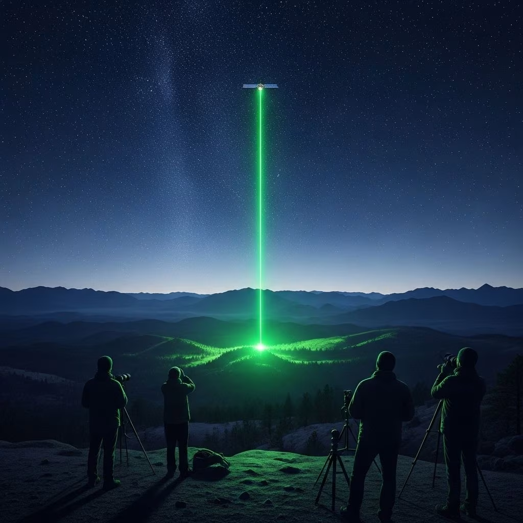
In late 2022, astonished skygazers in Japan witnessed a fleeting display of bright green laser beams streaking across the night sky—a phenomenon that prompted intrigue and speculation. These spectacular lights, initially thought by some to be meteors or other atmospheric events, have since been conclusively identified: they were the visible workings of NASA’s advanced ICESat-2 satellite, equipped with a high-powered green laser. This marked the first time ever that these elusive laser beams were photographed from Earth, offering a rare glimpse into the sophisticated technology NASA uses to observe our planet from space.
How the Mystery Unfolded: Astronomer’s Unlikely Discovery
The story begins with Daichi Fujii, curator at the Hiratsuka City Museum in Japan. Using a homemade motion-detection camera aimed at the night sky, Fujii recorded an event that would soon capture the attention of astronomers and the public alike. On September 16, 2022, his camera spotted three dazzling green streaks cutting through the darkness over Japan—lights unlike any Fujii had seen before.
- Upon reviewing the footage, Fujii noticed a tiny green dot intermittently flaring in the clouds as the beams flashed past—a telltale sign that the light source was not terrestrial.
- He initially suspected a meteor, but quickly ruled it out after matching the event with satellite orbital data.
- Confirmation: NASA’s ICESat-2 satellite was directly overhead that night, its instrument firing laser beams downward.
This observation was soon shared with the ICESat-2 scientific team, who were equally surprised and enthralled—it was the first verification from the ground of their satellite’s green laser beams in action.
The Power and Purpose of NASA’s ICESat-2
The ICESat-2 (Ice, Cloud, and Land Elevation Satellite 2) is among NASA’s most sophisticated Earth-observing satellites, launched in 2018 as part of its Earth Science mission portfolio. Its primary role is to map ice loss, measure snow and water heights, and collect vital data on topography and climate by shooting rapid pulses of light towards Earth’s surface.
- ICESat-2 uses a technology called lidar (Light Detection and Ranging), which bounces laser light off the ground, ice, and water to precisely measure their elevations.
- The instrument—a laser altimeter—fires pulses 10,000 times per second, splitting into six beams that fan out as the satellite passes overhead.
- By counting the time it takes for these photons to make the journey down and back, scientists can chart changes in Earth’s polar ice, forests, lakes, and even shallow coastal waters.
Why Use Green Lasers?
The ICESat-2’s green laser (at a wavelength of 532 nanometers) is chosen because:
- It is highly effective at penetrating clear atmospheric conditions and reflecting off both ice and water surfaces.
- The return signal (backscattered photons) is easier to detect against the background of sunlight and atmospheric interference, boosting data accuracy.
The Rare Sight: How Were the Lasers Seen from Earth?
Despite firing powerful lasers from orbit approximately 300 miles (500 kilometers) above the surface, ICESat-2’s beams are typically invisible from the ground. This is due to several factors:
- Lidar pulses are extremely brief and scattered, making direct observation a challenge.
- For the laser to appear visible, conditions must be just right:
- The satellite must be directly overhead.
- Clouds or atmospheric moisture must be present to scatter the laser light, but not so dense as to completely block it.
- The observer must be at precisely the right location and time, with the right camera settings and sensitivity.
On the night in question, all these factors aligned: Fujii’s camera caught the beams as they reflected off low clouds, scattering enough to be photographed.
Decoding the Science: What Does ICESat-2 Measure?
The impact of ICESat-2’s measurements is far-reaching, informing climate research, resource management, and global environmental monitoring. Here’s what makes its mission so crucial:
- Ice Sheet Monitoring: Accurately tracks ice losses from Greenland and Antarctica, informing projections of sea level rise.
- Sea Ice Thickness: Maps the distribution and seasonal changes of polar and sea ice.
- Terrestrial Elevations: Measures land surface heights, including forests, mountains, and valleys, contributing to biomass and vegetation studies.
- Freshwater Reservoirs: Assesses the heights of lakes, reservoirs, and rivers, crucial for water resource assessment.
- Coastal Mapping: Details the shifts in coastline and shallow water depths, aiding in mapping flood risks and erosion.
Is the Laser Dangerous?
Understandably, the idea of an orbital satellite raining down laser beams might raise concerns. NASA has addressed this directly:
- The ICESat-2’s laser is not harmful to humans, animals, or aircraft at the altitudes where it operates.
- According to NASA’s scientists, if a person stood directly beneath the path of the satellite and looked up, the flash from the laser would be no stronger than that of a camera flash viewed from more than 100 yards away.
- Aircraft-safety protocols ensure that beams are not a hazard to aviation.
This ensures the laser system can be used for precision science without interfering with everyday life below.
The Significance of the First Photographed Beams
This event is scientifically significant and symbolically powerful:
- It marks the first ground-based detection of ICESat-2’s green lasers—the only time these beams have ever been seen or recorded by human-made instruments on Earth.
- It demonstrates how ground observers can occasionally witness the hidden work of space technology, given the right conditions.
- The footage provides inspiration for public science engagement, highlighting international collaboration and curiosity in action.
Astronomy, Technology, and Citizen Science
The capture of ICESat-2’s beams was made possible by both advanced technology and the dedication of an amateur astronomer—showcasing how citizen science complements and enhances professional research.
- Motion detection cameras: Fujii’s device was simple yet effective, leveraging image sensors and software to detect unusual events in the sky.
- Online data sharing: Once recognized, Fujii’s discovery was rapidly shared on social media and science forums, leading to direct communication with NASA teams.
These collaboration channels are increasingly important for science: they let discoveries surface faster, promote global dialogue, and inspire the next generation of explorers.
A Glimpse into the Future of Earth Observation
NASA’s deployment of laser-based lidar satellites like ICESat-2 represents a leap forward in our ability to understand the rapid changes on our planet. Looking to the future, advancements in Earth observation may include:
- Higher resolution mapping: Enabling even finer detection of changes on land and water.
- Multispectral lidar: Using different laser colors/wavelengths to study a broader array of natural features.
- Satellite fleets: Deploying networks of satellites to ensure constant global monitoring, enhancing climate prediction models.
- Direct public access to satellite data: Allowing citizens, researchers, and governments to monitor trends in real time.
The intersection of advanced laser science, orbital platforms, and inspired ground-based observation keeps pushing the boundaries of what’s possible in understanding Earth from space.
Frequently Asked Questions (FAQs)
Q: What exactly are the green lasers seen in the sky over Japan?
A: The green lights were laser pulses emitted by NASA’s ICESat-2 satellite, which uses lidar technology to measure Earth’s surface elevation and ice thickness from space.
Q: How often can people see these satellite laser beams from the ground?
A: Observing the beams from Earth is extremely rare—specific weather, satellite positioning, and camera sensitivity are needed for them to be visible. This recent event was the first time they were photographed from the ground.
Q: Are NASA’s lidar lasers harmful to humans or the environment?
A: No, the lasers are not harmful. The intensity is comparable to a distant camera flash when viewed from the ground, and aviation protocols ensure safety for all airborne traffic.
Q: What scientific value does the ICESat-2 mission provide?
A: ICESat-2 provides crucial data for tracking shrinking ice sheets, monitoring sea level changes, measuring land heights, mapping forests, and supporting flood risk analysis worldwide.
Q: Could similar laser-based satellites be launched in the future?
A: Yes, future Earth observation missions are likely to use even more advanced laser and lidar technology, improving our ability to monitor, understand, and manage natural resources and climate change.
Key Takeaways: NASA’s Visible Laser Beams and Their Impact
- The recent sighting of green laser beams over Japan was the first time NASA’s ICESat-2 lidar system was recorded from Earth, making it a landmark event in citizen science and technology.
- ICESat-2’s mission gathers essential data on ice, water, and land, directly informing global understanding of climate change and environmental management.
- The phenomenon highlights the growing synergy between professional research and citizen scientists—together, they expand the boundaries of discovery in our world and beyond.
References
- https://www.space.com/nasa-green-lasers-satellite-photo
- https://www.nasa.gov/missions/icesat-2/thats-no-meteor-nasa-satellites-elusive-green-lasers-spotted-at-work/
- https://www.nasa.gov/centers-and-facilities/goddard/thats-no-meteor-nasa-satellites-elusive-green-lasers-spotted-at-work/
- https://phys.org/news/2023-04-nasa-satellite-elusive-green-lasers.pdf
- https://petapixel.com/2023/04/17/astronomer-captures-nasas-mysterious-green-laser-beams/
- https://scitechdaily.com/mysterious-green-lasers-near-mount-fuji-japan-have-a-chilling-explanation/
- https://www.techtimes.com/articles/290410/20230415/mysterious-green-laser-beams-streak-japan-is-it-a-meteor.htm
- https://www.livescience.com/bright-green-laser-lines-shoot-across-night-sky-in-hawaii-what-caused-them
- https://www.popularmechanics.com/space/satellites/a42998251/nasa-says-china-flashed-green-lasers-over-hawaii/
- https://www.sciencetimes.com/articles/42309/20230209/hawaii-green-laser-beam-nasas-icesat-2-atlas-chinas-daqi.htm
- https://www.sciencealert.com/ominous-green-lasers-shot-over-hawaii-didnt-come-from-nasa-satellite-after-all
- https://news.utexas.edu/2019/06/26/ut-partners-with-nasa-using-green-laser-technology-to-predict-climate-change/
- https://www.youtube.com/watch?v=xsiP99cwwr0
- https://petapixel.com/2023/02/10/mysterious-green-laser-beams-over-hawaii-came-from-chinese-satellite/
- https://www.youtube.com/watch?v=FsPnyhuh1PM
- https://www.jameswebbdiscovery.com/universe/china-moon-laser-targeting-what-it-means-for-space-exploration
- https://www.photonics.com/Articles/NASA_Laser_Technology_Tracks_Changes_in_Polar/a55826